
Geoinformatics Laboratory "Location Thinkers"
School of Computing and InformationLocation Based Services (LBS) Concept Diagram
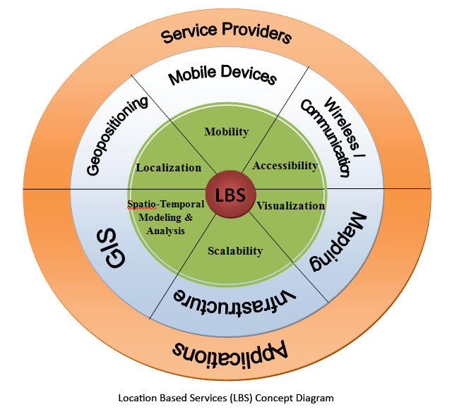
Location Based Services (LBS) Concept: This diagram illustrates the concept of LBS as viewed by our lab. At the center core is the idea of LBS. The first ring (green) represents concepts involved within the study of LBS. The second ring (blue) represents technologies that are associated with the underlying concepts. The outer ring (orange) illustrates how users access LBS, through both the service providers and applications which may use an application programming interface (API).
Geoinformatics Concept Diagrams:
Geoinformatics Layers |
Interdisciplinary Fields |
Location Based Services (LBS) |
Navigation