
Geoinformatics Laboratory "Location Thinkers"
School of Computing and InformationNavigation Concept Diagram
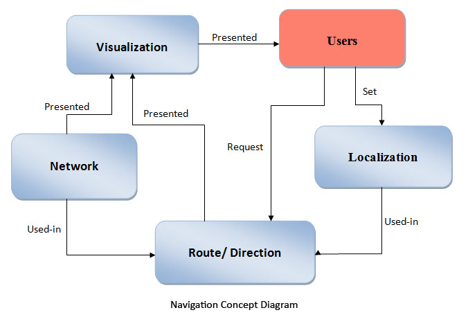
Navigation Concept: This diagram illustrates the concept of navigation as viewed by our lab. Starting with the User entity, the User provides their location via geopositioning technologies (GPS, IP-to-Address, etc.). The user also makes a request for a route/direction to get somewhere. The Location that was originally provided is used in determining the route to establish a starting point. The Route entity also requires the network entity (a road network in the case of car navigation systems) in order to determine the route to follow within the network. These Route and Network entities are presented through a Visualization entity, usually the Route is overlayed on the underlying Network. This Visualization is then ultimately presented back to the User to provide them a means for navigation.
Geoinformatics Concept Diagrams:
Geoinformatics Layers |
Interdisciplinary Fields |
Location Based Services (LBS) |
Navigation